Geosense is a reputable independent geological remote sensing consultancy that has gained global recognition for its top-quality remote sensing services. Over the last 35 years we have built up a unique experience in the use of satellite, airborne and ground based remote sensing technology and interpretations for mineral exploration.
Alteration mapping and target generation using spectral information from satellites (e.g., Landsat, ASTER, WorldView-3, Sentinel-2, EnMAP), aircraft (hyperspectral imaging) and portable infrared spectroscopy (field mapping and core logging) provides a very powerful exploration tool. Geosense covers different phases of exploration, from regional scale generative projects, for the identification of alteration systems and the detection of basement structures, to the project scale, for accurate mineralogical mapping and the structural geological setting of individual targets.
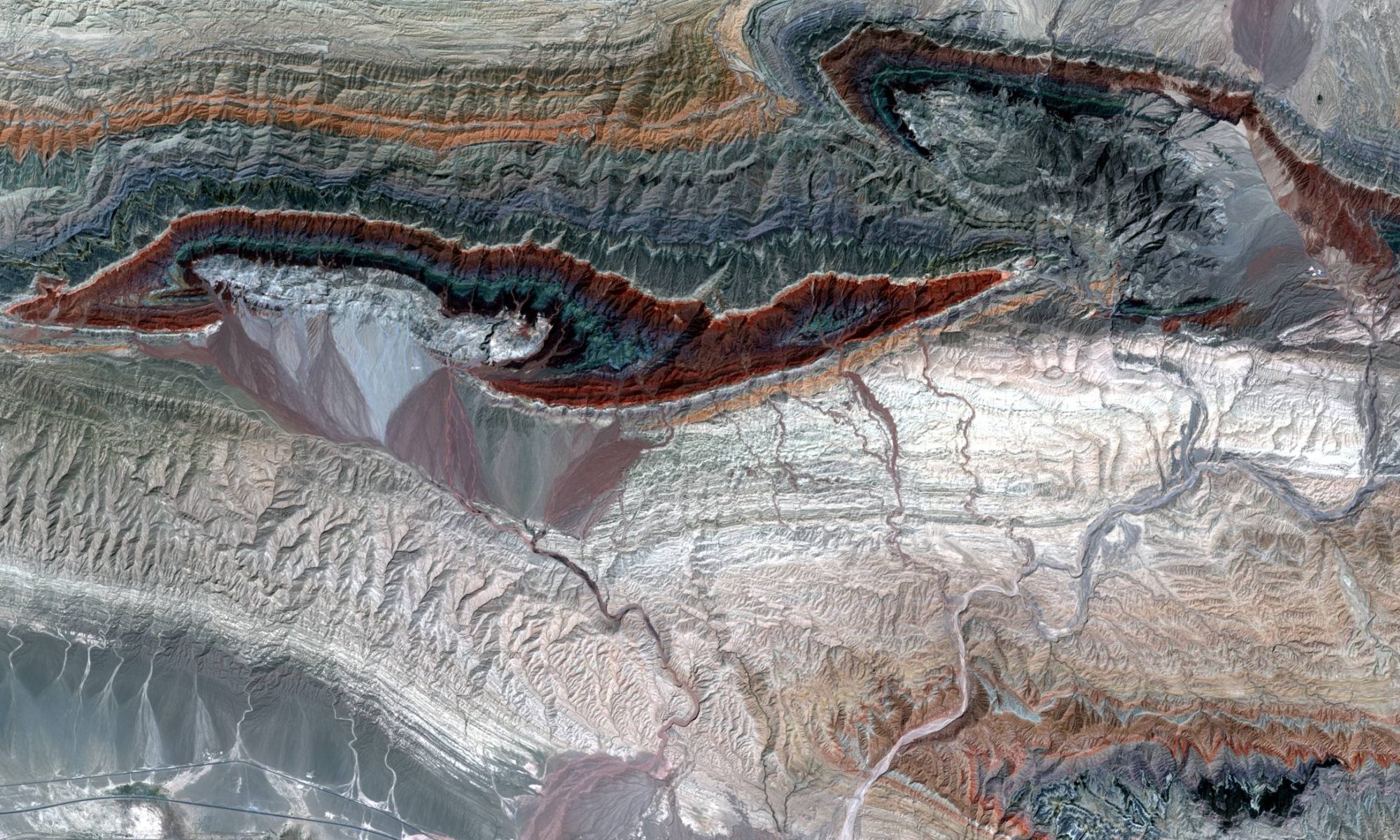
While spectral mapping techniques can be highly effective for detection of exposed alteration, there are many situations where this is not the case. There are many situations where an orebody is located at such depth that its alteration halo does not reach the surface, hence is not directly detectable with spectral methods.
Also, there are major parts of the world where the superficial signs of alteration are (partly) covered by an unrelated blanket (dense vegetation, snow, rock debris, alluvium, glacial till, wind-blown material, desert staining, laterites, etc.). In these cases, it can be important to look at indirect indicators, such as structure, stratigraphy, lithological changes geomorphology, land-use and vegetation patterns. Remotely sensed images, and their derivatives, such as Digital Elevation Models (DEMs), are very suitable tools to map these features with high accuracy and in great detail. Again, this can be done at a regional scale, using relatively low-resolution imagery, and at prospect scale, using very high-resolution data, such as <1m resolution satellite imagery, or even Drone imagery, with spatial resolution up to one or two centimeters. Many Geosense projects cover the whole range, from regional to prospect scale, to help understand the geological context of the targets across these scales.
Geosense has an all-round team of experts under one roof, and is able to cover the complete range of remote sensing services required for optimal support of a mineral exploration project. Get in touch with Geosense to see how we can help you out at your project.
Our services include:
- Spectral analysis, Alteration Mapping and Target Generation. Specialists in Epithermal, Mesothermal, Porphyry, Skarn, IOCG and Lateritic mineralization
- Geological Mapping, focused on Structure and Stratigraphy
- Hyperspectral analysis
- Fieldwork: spectroscopic ground-truthing and alteration mapping
- Structural analysis and terrain analysis
- Spectroscopic core-logging
- Processing of optical imagery such as Landsat, Aster, Sentinel-2, Ikonos, Quickbird, GeoEye and WorldView-3
- Custom made Colour Composites, Ortho-images, Digital Elevation Models, topographic basemaps etc.
- Environmental mapping and vegetation monitoring
- Environmental monitoring of mining projects