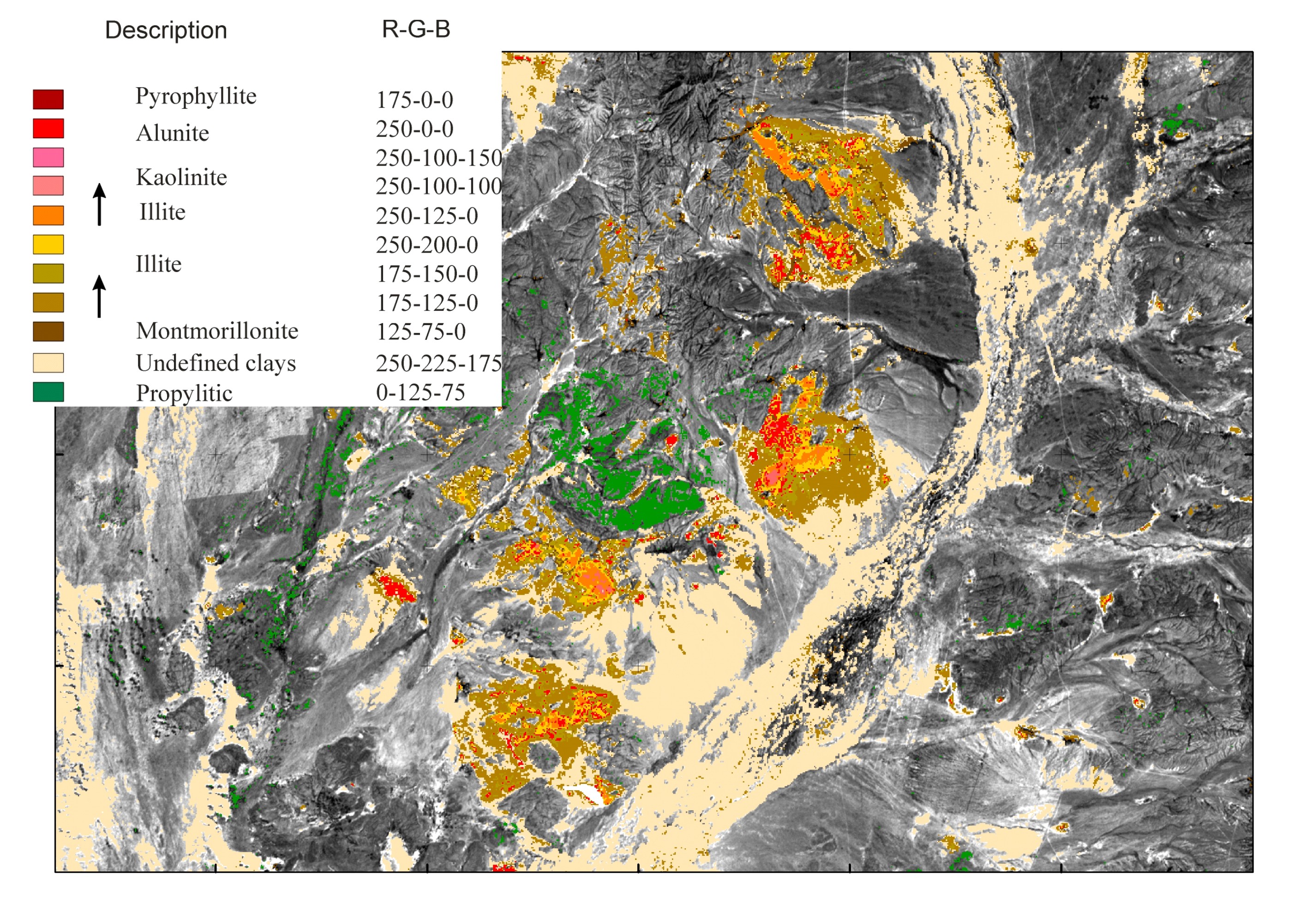
One of our specialties is the spectral interpretation of multispectral satellite imagery such as Landsat, Aster, Sentinel and WorldView-3 in order to locate potential alteration and to map zoning in hydrothermal alteration systems.
Our experience with spectral analysis ranges from large regional projects, covering hundreds of Aster scenes, down to the prospect scale with very detailed datasets (WV3 and airborne hyperspectral data).
Spectral analysis is not just a matter of blunt processing through the use of complex algorithms. Above all, it is an art!
Every project requires its own tailor-made approach. It requires experience and a lot of manual fine-tuning in order to be able to recognize subtle features, patterns and tonal subtleties, which are often characteristic for zoned alteration systems.
Over the past 25 years we have worked successfully on a variety of alteration systems around the globe, such as:
- – High-sulphidation systems
- – Low and intermediate sulphidation
- – Porphyry systems
- – IOCG-systems
- – Skarns
- – Iron-ore deposits
- – Bauxite & nickel laterite environments
Processing of individual scenes as well as demanding projects, such as the interpretation of large parts of Turkey, Kazakhstan, Tibet, Ethiopia, Peru, Mexico, US or Chile, is our daily work.
With the number of satellites growing, it is now possible to map at a level of detail that wasn’t possible before. The downside is that just choosing the right data can be a daunting task.
In each project, big or small, we see it as our responsibility to carefully guide our client in order to make sure that the client receives the best possible product for his project in a most cost-effective manner.